|
Description:
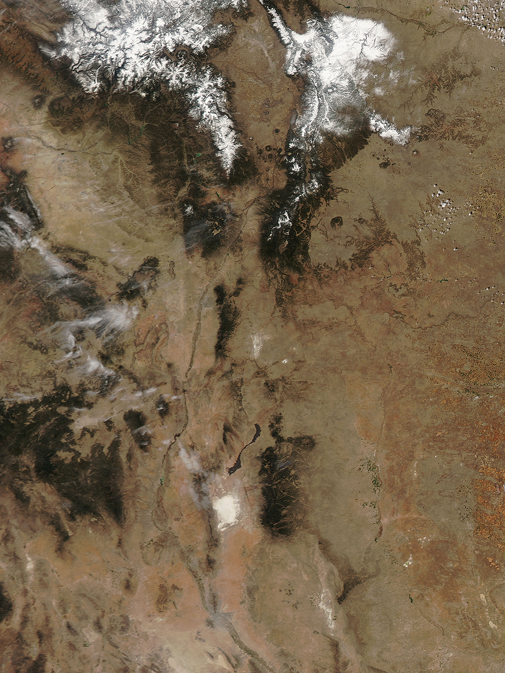
White Sands From a Satellite.
New Mexico Satellite: Aqua
On April 4, 2011 the Moderate Resolution Imaging
Spectroradiometer (MODIS) aboard NASAs Aqua satellite passed
over the southwestern United States and captured this true-color
image of a nearly cloud-free spring day in New Mexico.
On April 5, the National Drought Mitigation Center reported that
central New Mexico was suffering from a D2 (Severe) drought,
while southern New Mexico was even drier, with D3 (Extreme)
drought conditions. As can be seen in this image, most of the
lands of the state are colored tan and reddish-brown, indicating
arid land which is lacking vegetation.
The large white circle in southern New Mexico is the area known
as White Sands, a highly-light reflective desert located in the
Tularosa Basin. The sand in this area is made of gypsum and
calcium sulfate, and appears bright white. It also has a very
high rate of evaporation of surface moisture.
Moisture is evident in the highest elevations, with snow lying
on the peaks of the mountains of northern New Mexico. Many
mountains are also covered with green, indicating living
vegetation, most likely in the form of forests, and suggesting
adequate precipitation to support vegetative growth in these
areas, even in drought conditions.
Not only has New Mexico been extremely dry in the first months
of 2011, it has also experienced prolonged high temperatures,
low humidity and strong spring winds. These conditions have
fueled multiple fires across the state. Lines of gray smoke
appear to blow across the land in several locations in this
image, including from the green circle marking the Jemez
Mountains near Los Alamos. Also, in the green area to the
northeast of White Sands, smoke continues to rise from a large
fire known as the White Fire, leaving a thin film of haze over
the area.
Credits:
Jeff Schmaltz. MODIS Land Rapid Response Team, NASA GSFC
Return to What Else To Do In The Area
Return to
photo gallery
 
|
 |